


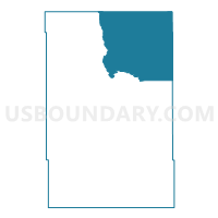
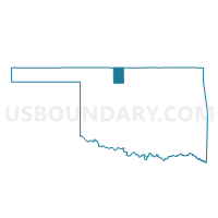
Voting District 120, Alfalfa County, Oklahoma
About
Outline

Summary
| Unique Area Identifier | 653473 |
| Name | Voting District 120 |
| County | Alfalfa County |
| State | Oklahoma |
| Area (square miles) | 158.83 |
| Land Area (square miles) | 158.70 |
| Water Area (square miles) | 0.13 |
| % of Land Area | 99.92 |
| % of Water Area | 0.08 |
| Latitude of the Internal Point | 36.90687840 |
| Longtitude of the Internal Point | -98.22433090 |
Maps

Graphs
Select a template below for downloading or customizing gragh for Voting District 120, Alfalfa County, Oklahoma


Neighbors
Neighoring Voting District (by Name) Neighboring Voting District on the Map
- Voting District 110, Alfalfa County, OK
- Voting District 130, Alfalfa County, OK
- Voting District 140, Alfalfa County, OK
- Voting District 6, Grant County, OK
- Kiowa East Township Voting District, Barber County, KS
- Township 2 Voting District, Harper County, KS
- Township 3 West Voting District, Harper County, KS
Top 10 Neighboring County Subdivision (by Population) Neighboring County Subdivision on the Map
- Cherokee CCD, Alfalfa County, OK (2,078)
- Southwest Grant CCD, Grant County, OK (1,475)
- Kiowa township, Barber County, KS (1,136)
- North Alfalfa CCD, Alfalfa County, OK (729)
- Wakita CCD, Grant County, OK (638)
- Township 3, Harper County, KS (300)
- Township 2, Harper County, KS (115)
Top 10 Neighboring Place (by Population) Neighboring Place on the Map
Top 10 Neighboring Unified School District (by Population) Neighboring Unified School District on the Map
- Anthony-Harper Unified School District 361, KS (5,086)
- Timberlake Public Schools, OK (2,904)
- Cherokee Public Schools, OK (1,783)
- South Barber Unified School District 255, KS (1,575)
- Wakita Public Schools, OK (743)
- Burlington Public Schools, OK (607)
Top 10 Neighboring State Legislative District Lower Chamber (by Population) Neighboring State Legislative District Lower Chamber on the Map
- State House District 58, OK (33,694)
- State House District 80, KS (20,532)
- State House District 116, KS (19,915)
Top 10 Neighboring State Legislative District Upper Chamber (by Population) Neighboring State Legislative District Upper Chamber on the Map
Top 10 Neighboring 111th Congressional District (by Population) Neighboring 111th Congressional District on the Map
- Congressional District 3, OK (732,394)
- Congressional District 4, KS (720,192)
- Congressional District 1, KS (655,310)
Top 10 Neighboring Census Tract (by Population) Neighboring Census Tract on the Map
- Census Tract 9565, Grant County, OK (3,052)
- Census Tract 9682, Barber County, KS (1,723)
- Census Tract 9617, Harper County, KS (1,478)
- Census Tract 9564, Grant County, OK (1,475)
- Census Tract 9556, Alfalfa County, OK (1,469)
Top 10 Neighboring 5-Digit ZIP Code Tabulation Area (by Population) Neighboring 5-Digit ZIP Code Tabulation Area on the Map
- 67003, KS (2,626)
- 73728, OK (1,861)
- 67070, KS (1,169)
- 73771, OK (495)
- 73749, OK (448)
- 73722, OK (427)
- 73758, OK (197)
- 67061, KS (171)
- 73719, OK (83)
- 67150, KS (12)